


Winter storms that strengthen rapidly -- including nor'easters -- are dubbed "bomb cyclones."
The term “bombogenesis” comes from mid-latitude storms that intensify rapidly, dropping 24 millibars (or atmospheric pressure) over a 24-hour span, according to the National Oceanic and Atmospheric Administration (NOAA).
A typical range in millibar change is around 10 to 15 in 24 hours.
WHAT IS A NOR'EASTER? THE CLASSIC EAST COAST STORMS EXPLAINED
Read on for a look at these storms, and how often they can occur.
What is a bombogenesis?
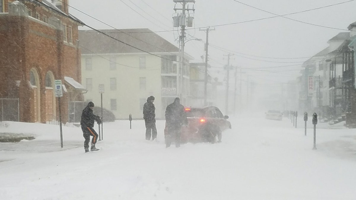
Heavy snow and wind from a "bomb cyclone" is pictured. (Wildwood Police Department)
The term bombogenesis is a popular term used by meteorologists to refer to a rapidly intensifying area of low pressure, according to Fox News Senior Meteorologist Janice Dean.
“The central pressure of an area of low pressure [winter storm] must drop at least 24 millibars in 24 hours to qualify,” Dean explained. “Several major impacts will include strong winds, beach erosion and coastal flooding especially with high tide.”
A decrease in pressure intensifies the power of the storm, Chris Bianchi, a meteorologist for WeatherNation TV, explained to the Denver Post.
A bombogenesis storm can be tropical or non-tropical, AccuWeather senior meteorologist Alex Sosnowski said in a blog post.
“In this case, bomb refers to explosive development. Altogether the term means explosive storm strengthening.”
“The term bombogenesis comes from the merging of two words: bomb and cyclogenesis. All storms are cyclones, and genesis means the creation or beginning,” Sosnowski said. “In this case, bomb refers to explosive development. Altogether the term means explosive storm strengthening.”
Bianchi said proximity to a large body of water, particularly an ocean, during cold months contributes to the creation of a bomb cyclone.
"The difference in temperature between the normally warmer ocean (particularly in the Atlantic, with the Gulf Stream pumping up warmer water from the south) and the cold landmass often creates the fuel source for powerful East Coast lows," he stated in a blog post.
What happens during one of these storms?
If you’re caught in the path of a bomb cyclone, you could expect to see intense wind gusts or large amounts of snow.
The intensity of a bomb cyclone oftentimes peaks once the storm reaches New England, according to Wired.
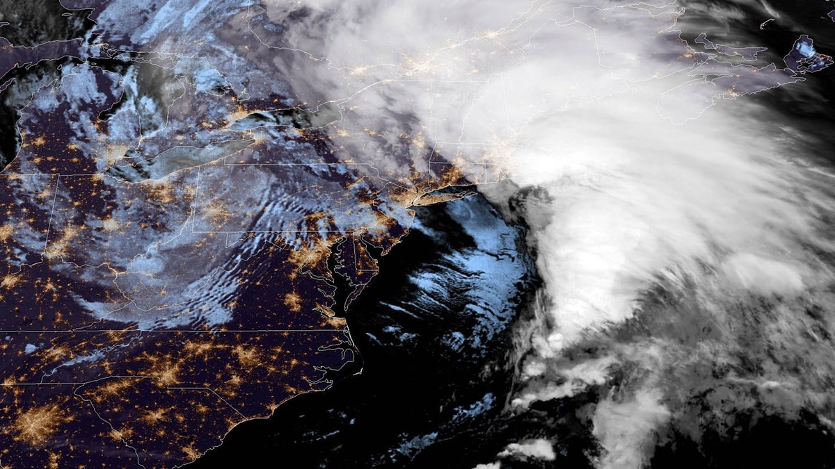
The "bomb cyclone" can be seen off the coast of the Northeast on Oct. 17, 2019. (NOAA/GOES East)
"The name isn’t an exaggeration — these storms develop explosively and quickly. They can produce destructive winds, coastal flooding and erosion, and, of course, very heavy precipitation. If the term conveys the importance and the danger associated with them, then I think that’s a good thing," John Gyakum, a professor of atmospheric science at McGill University in Montreal who says he helped coin the weather nickname, previously told The Washington Post.
Are they unusual?
It’s not unusual to get at least one storm that is classified as a bomb cyclone a year, Bryan Jackson, a meteorologist with NOAA's Weather Prediction Center, previously told Fox News.
Bombogenesis nor'easters actually occur most winters, WNYW-TV reported.
While a few storms every year are considered to be "bomb cyclones," Gyakum believes there may be even more in the future due to warmer ocean temperatures and rising sea levels.
"These storms feed off the temperature gradient between the mild Gulf Stream and cold air over the land. Climate change could also periodically cause cold air to spill farther south, and when the two meet, there’s an increased risk for these extreme storms," he told the Post.
Fox News' Travis Fedschun contributed to this report.

Get all the stories you need-to-know from the most powerful name in news delivered first thing every morning to your inbox